Our website uses Cookies - by using this site or closing this message you're agreeing to our Cookie Policy and Privacy Policy
xPlaces
 An important part of knowing about your ancestors is knowing about where they lived, and what it was like to live there at that time. I have a large collection of PDF-format gazetteers of the UK and Ireland, and can extract from them descriptions of most parishes, chapelries and townships in the UK, as well as many more minor places. Inserted into your book at strategic points, these scanned images can provide interesting insights into life ‘there-and-then’.
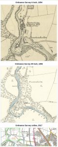
There are a number of online sources for both current and period Ordnance Survey and other maps of the UK; I can include map snippets showing where your ancestors lived, both then and now. I can also supply latitude and longitude data, so you’ll be able to locate these places, both in online mapping, and in the real world using GPS or satnav.
For places in the South Lakes area, I may be able to visit the location and take photos of it as it is today, for inclusion in your story. I may also be able to assist with route-planning, if you intend to visit the area and the places where your ancestors once lived.
